
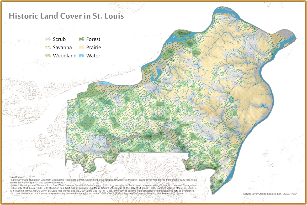
Historic Land Cover in St. Louis
This map is based on historic land cover recorded in General Land Office (GLO) field notes conducted in the mid 1800s. Historic hydrology within the city of St. Louis was derived by staff at at East-West Gateway Council of Governments from a number of historic maps including the 1904 US Geologic Survey topographic map of St. Louis.
The map image is used for an iNaturalist project for observations collected within the boundary served by the Great Rivers chapter of the Missouri Master Naturalist program.